1
/
of
1
Drone Nerds
GeoCue TrueView 720 Traditional
GeoCue TrueView 720 Traditional
Regular price
$270,000.00 USD
Regular price
Sale price
$270,000.00 USD
Unit price
/
per
Shipping calculated at checkout.
Couldn't load pickup availability
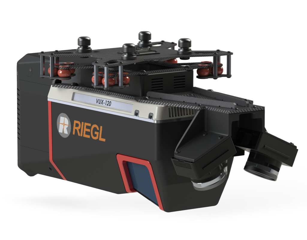
A NEW CLASS OF SYSTEM FOR NEW CHALLENGES: TRUEVIEW 720 WITH 3 LASER CHANNELS + IMAGERY COLLECTION
TrueView 720 is our fourth generation RIEGL integration. This is the system for high point density corridor mapping. Using the RIEGL VUX-120 with 3 lidar scanners (oriented nadir and +10 degrees forward and -10 degrees backward) and 3 oblique/nadir cameras for extremely detailed data collection in one flight path. When scanning power lines, users will be able to capture the poles vertically, front and back.
| Data Collection | LiDAR + Imagery |
| LiDAR Scanner | RIEGL VUX-120 |
| LiDAR Returns | Up to 32 |
| LiDAR Range - usable | 720 m for targets with > 20% reflectivity |
| Positioning and Orientation System | Applanix APX-20, ask for other IMU options available |
| Pulse Repetition Rate | Up to 2.4 Mhz (selectable) |
| Scanner Performance |
|
| GNSS/INS Performance |
|
| System Performance |
|
| Camera Sensor | Triple 1” sensor with mechanical shutter, hardware mid-exposure pulse, 60 MP combined, RGB. Ask for further custom camera integration. |
| System Operation Temperature Range | -10° to 40° C |
| Mass | 3.4 kg (payload unit only - no accessories including battery, mount, antenna, power adapter) |
* 1 σ @ 150 m range under Riegl test conditions
Share